Ski resort Renčišov Búče #2999

4 €

4 €

3 €
1 €
0 €
Discounts when staying more days:
3 - 4 nights: 3%
5 - 9 nights: 5%
10 and more nights: 10%
 toilet
- V chate Bukvica
 drinking water
- From the cottage Bukvica
 electricity
- Extension cord From the Bukvica cottage
 shower / washroom
- V chate Bukvica
 picnic table
 grill
grill
 campfire ring
 Greywater (shower, washing)
- V chate Bukvica
 Chemical toilet
- Driveway
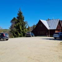
 Access to the property may be difficult in rainy weather
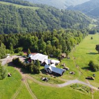
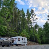
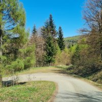
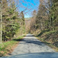
ASPHALT ROAD IN THE WHOLE SECTION. LOWEST SITE 3m.Suitable for smaller caravans and caravans towed by a powerful car. WARNING!!! - the road is about 3m narrow towards the end and is up a large incline with three 180 degree bends. I recommend shifting into first gear!
 Restriction of the access road
HIGHEST PLACE 3m. ATTENTION!!! - the road is about 3m narrow towards the end and is up a big climb with three 180-degree turns. I recommend shifting into first gear!
 cycling
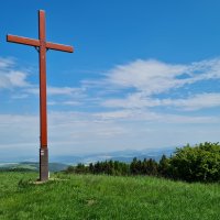
Bachureň is the highest hill of the mountain of the same name, which in the ranking of the highest Slovak mountains occupies the middle 30th place from the total number of 59. The unremarkable mountain Bachureň is forested, only in the west there is a section from the top with views of the nearby Levoča Hills, the valley of the Black Swamp and the High and Low Tatras in the background.The access to the top is by a trail from the saddle below Bachurňa (1010 m), distance 650 m. Except for one short climb, it is climbable in the saddle of a bayou.The saddle below Bachurňa can be reached by several paths. For example, from Lačnov (783 m) along the cross below Búče and via Sedlo pod Magurou it is 5.3 km. A shorter but steeper road from Lačnov leads along the chapel and again through the Saddle under Magura for 3.5 km. A nice and smooth ascent is from Renčišov (610 m) next to the Bukvica hut through the Búče saddle 7.3 km. From Sedlo pod Marduňou (751 m) along the ridge it is 6.5 km. Other ascent options are via Lačnovské sedlo, Kopytovská dolina, via Mindžová, Čierny bog valley...Recommended route: An inconspicuous cycling peak with good western views and well-preserved nice natural environment.
 fishing
Pond used in winter to make artificial snow 0.5km from the cottage. No permit required.
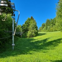
 winter sports
 hiking
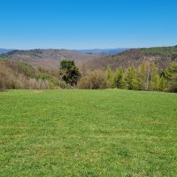
The Bachureň Mountains, situated in northeastern Slovakia in parts of the districts of Sabinov and Prešov, do not stand out neither in height nor in bizarre rock formations, nor do they offer far-reaching views of half of Slovakia, and even the interesting fact that as many as 108 species of molluscs have been found here will probably not impress very many people. Nevertheless, this mountain is quite often visited by tourists. This is due to its beautiful nature and the easy nature of the local hiking trails. One of Bachurne's visitor destinations is its eponymous highest peak, which rises to an altitude of 1081 metres above sea level. On its summit there is a bench from which you can enjoy a nice, if limited, view, among other things, for example, of the High Tatras. The hill is accessible by marked hiking trails leading from the villages of Nižný Slavkov, Vyšný Slavkov or Lačnov to Sedlo pod Bachurňou. From this saddle you can take an unmarked trail to the top. Those who choose this hike will be rewarded, among other things, by the quanta of berries found along the forest road.
Arrival from: 12:00
Departure until: 12:00
Can I come anytime?
 pets allowed
Rules for stays with dogs
 campfire allowed
 own grill allowed
 parties and noise prohibited, please keep quiet also during the day
More info
I will stay in: (What should I select in my case?)
Number of persons:
Date:


 69 %
69 % 


 Money-back guarantee